Mitigation Banks and Credits
Paint Rock Stream and Wetland Mitigation Bank

BRW has completed construction of the Paint Rock Creek Stream and Wetland Mitigation Bank on a 75-acre tract in Roane County, Tennessee. The project restored and established 11,360 linear feet of stream and rehabilitated, established and re-established nearly 50 acres of wetlands. We have planted over 36,000 native trees and shrubs on the site. The former cattle pasture will now be a functional, forested riparian corridor in perpetuity. The bank will generate over 4,300 functional feet stream mitigation credits and nearly 37 wetland mitigation credits. The service area includes the Watts Bar Lake, Lower French Broad and Chickamauga Reservoir watersheds. We currently have functional feet stream credits available. Please contact us to discuss your mitigation needs.

Trampled and Eroding Banks on Paint Rock Creek, March 2017
West Fork Drakes Mitigation Creek
The West Fork Drakes Creek Mitigation Bank is located near Portland in Sumner County, Tennessee. Restoration was completed in May 2020 on 4,285 linear feet of two tributaries to West Fork Drakes Creek. The project included removing an obsolete farm pond dam, installing two miles of livestock exclusion fencing and planting over 10 acres of native riparian trees and shrubs. The project will generate 2124 functional feet stream mitigation credits, with a service area that includes the Barren River, Old Hickory Lake and Red River watersheds.
Released credits have been sold, but we will have a credit release in 2027. Please contact us to discuss your mitigation needs.

Dam removal and construction of 4,285 LF of restored stream completed May 2020
Notchy Creek Stream and Wetland Mitigation Bank
Blue Ridge Waterways has received IRT approval for the Notchy Creek stream and wetland mitigation bank in Monroe County, TN. The bank will provide wetland and functional feet stream mitigation credits in the Lower Little Tennessee, Watts Bar Lake and Middle Tennessee watersheds. When constructed, the bank will have restored over 9,500 linear feet of stream and 43 acres of wetland within a 67-acre property.
Please contact us to discuss your mitigation needs in East Tennessee.
Smith Hollow Mitigation Bank
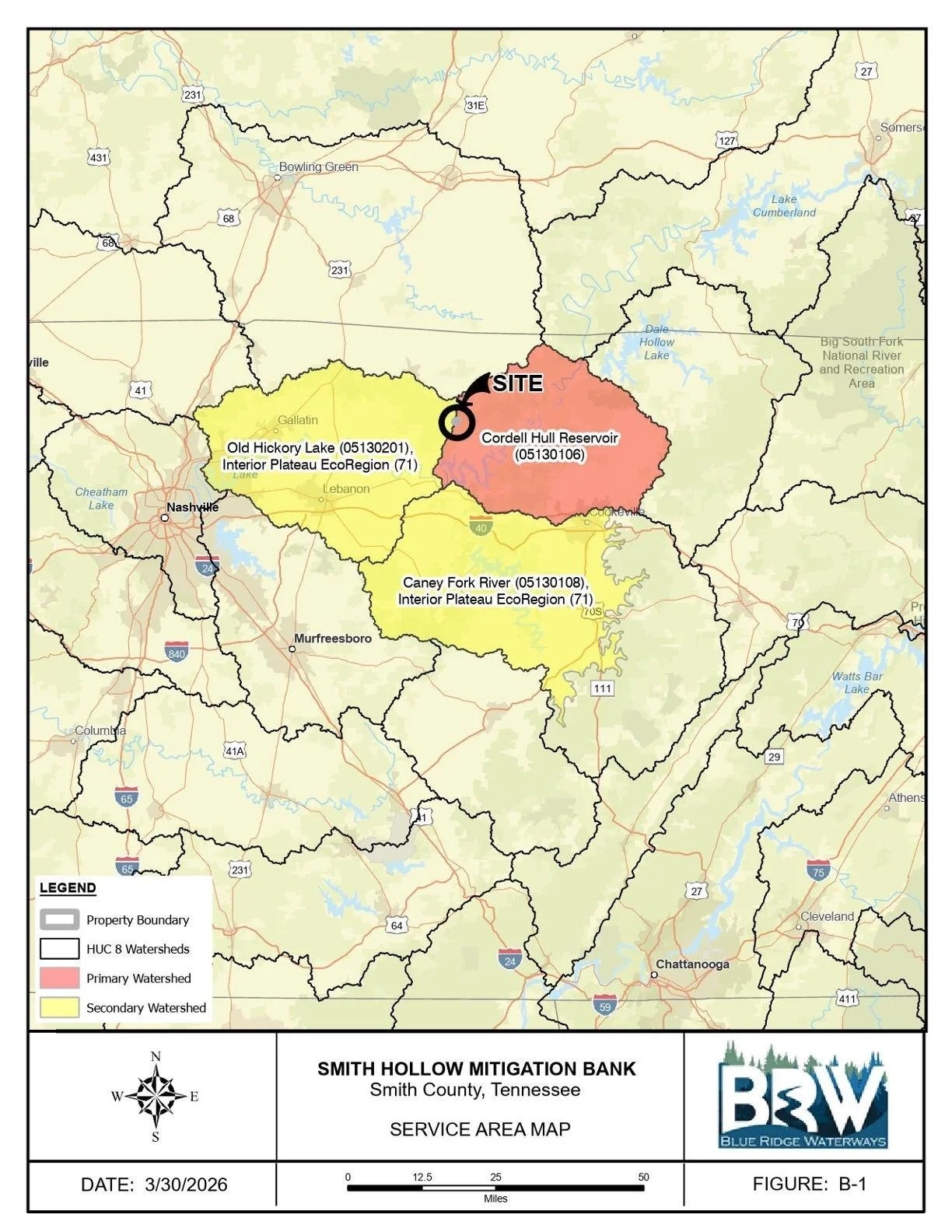
The Smith Hollow Mitigation Bank in Smith County, TN has received preliminary approval from the Interagency Review Team for compensatory mitigation for permitted stream impacts within a service area that includes the Old Hickory Lake, Cordell Hull Reservoir and Caney Fork River watersheds.
The completed project will restore approximately 6,650 LF of stream along unnamed tributaries and will generate approximately 1,978 functional feet credits.
We are expecting an initial credit release in 2026. Please contact us for stream mitigation in the service area.
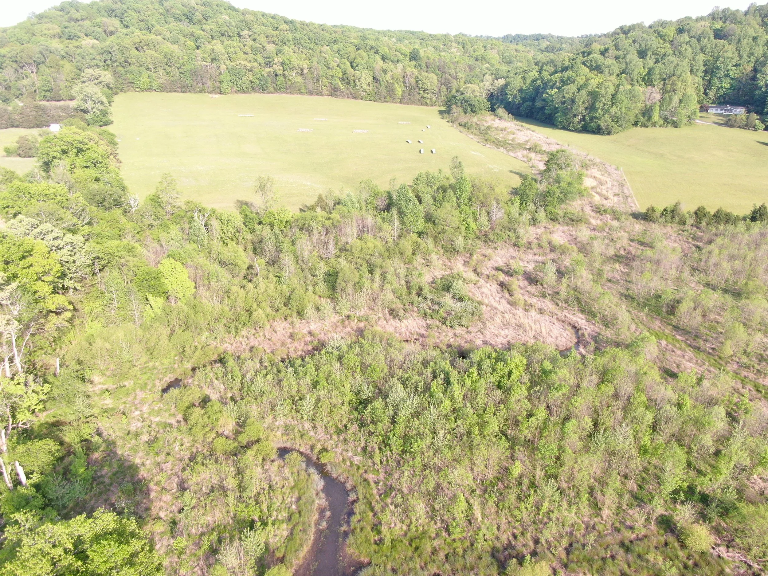
Year 6 Conditions, April 2026
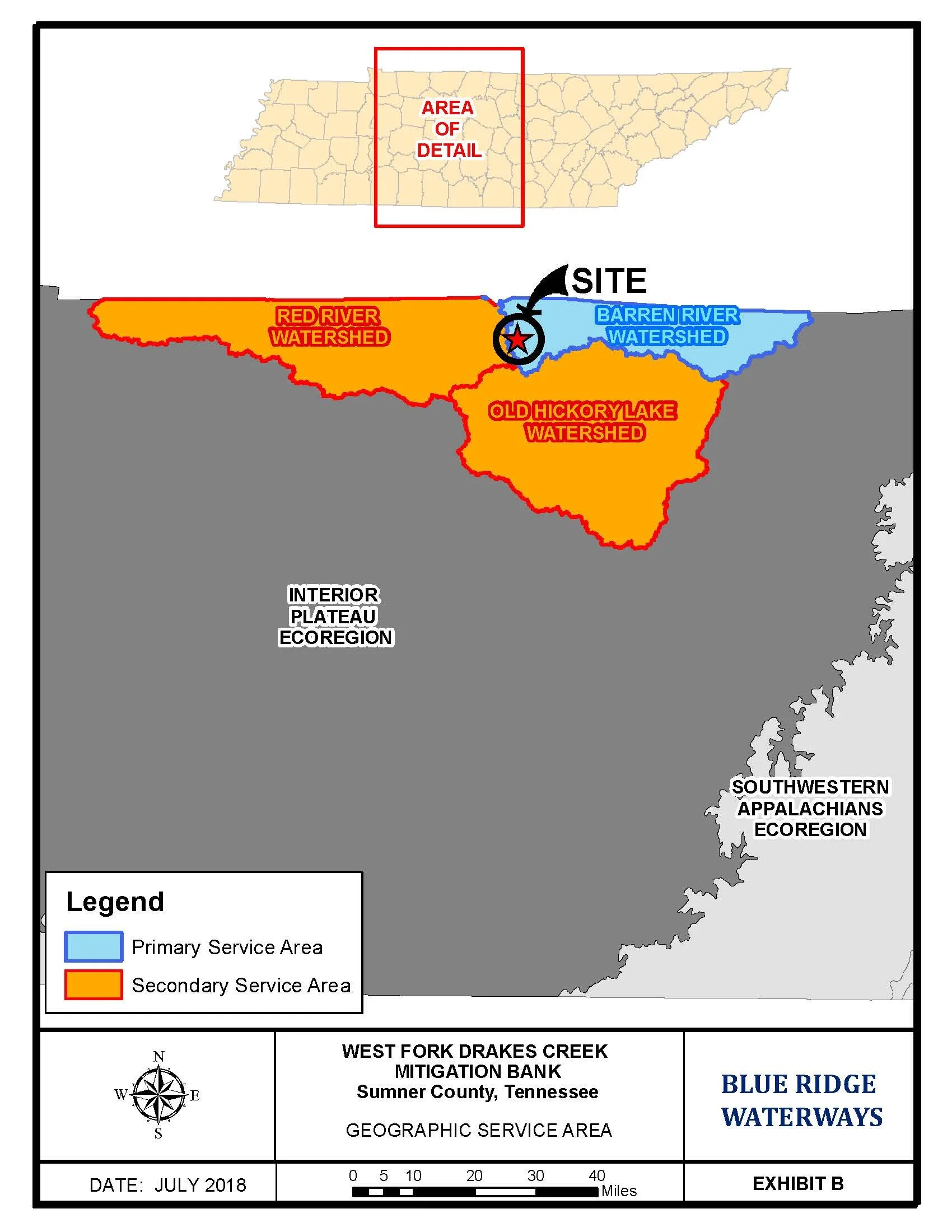

Year 4 Conditions, March 2024

Notchy Creek Mitigation Bank Service Area
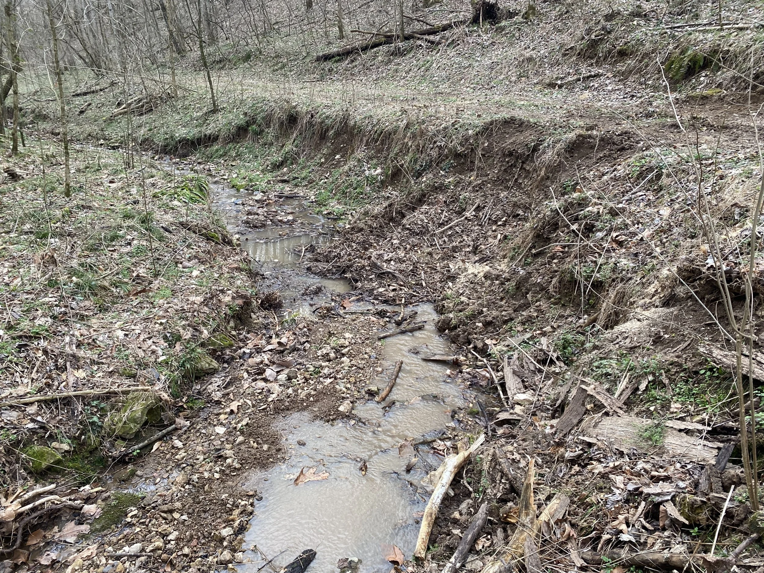
Degraded Tributary to be Restored